

Techniques Used in High-Precision GPS Surveys (RTK, PPK, DGPS)
How RTK, PPK and DGPS work to give centimetre-level positions.
Contents
- What Are the RTK, PPK and DGPS Techniques?
- 1. What Is High-Precision GPS?
- 2. RTK (Real-Time Kinematic) Survey Technique
- How Does It Work?
- Advantages:
- Disadvantages:
- 3. PPK (Post-Processed Kinematic) Survey Technique
- How Does It Work?
- Advantages:
- Disadvantages:
- 4. DGPS (Differential GPS) Survey Technique
- Uses:
- 5. RTK, PPK and DGPS Comparison Table
- 6. What to Consider When Choosing the Right Method
- Where Technology Meets Precision
In surveying engineering, positional accuracy is one of the most important factors that directly affect a project's success. Getting a point wrong by even a few centimetres can cause serious problems in cadastre, infrastructure, construction and engineering projects.
That is why high-precision GPS survey methods, above all RTK, PPK and DGPS techniques, are preferred today. With RTK, PPK and DGPS systems it becomes possible to reach centimetre-level accuracy in field work.
What Are the RTK, PPK and DGPS Techniques?
1. What Is High-Precision GPS?
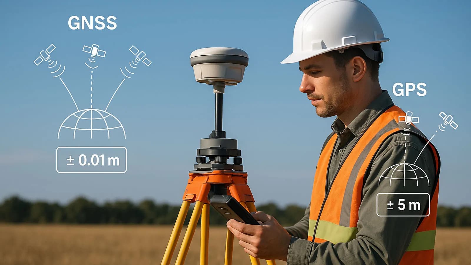
The Global Positioning System (GPS) determines position from signals received from satellites. However, standard GPS measurements usually have an error margin of 3 to 10 metres. To reduce this error, surveying engineers use differential correction methods (RTK, PPK, DGPS) that bring the accuracy down to the centimetre and even millimetre level.
2. RTK (Real-Time Kinematic) Survey Technique
RTK is one of the most widely used high-accuracy survey methods. In this system a reference station (base) and a mobile receiver (rover) work at the same time.
How Does It Work?
- The reference station receives raw data from the satellites.
- At the same time it sends this data to the rover over radio, GSM or the internet.
- The rover applies the corrections instantly and produces centimetre-level positions in real time.
Advantages:
- Results are available immediately.
- Time spent measuring in the field is short.
- Ideal especially for cadastre, construction setting-out and engineering projects.
Disadvantages:
- If the communication link (GSM, radio) drops, the survey stops.
- The range of the base station is limited (usually 10 to 20 km).
3. PPK (Post-Processed Kinematic) Survey Technique
PPK works much like RTK; the difference is that the corrections are applied afterwards, not in real time.
How Does It Work?
- Reference and rover data are recorded at the same time.
- After the survey, the corrections are applied with software (e.g. Trimble Business Center, RTKLIB, GNSS Solutions).
- This gives results as precise as RTK, in a more stable way.
Advantages:
- No data is lost even if there are connection problems.
- Ideal for drone photogrammetry and mapping flights.
Disadvantages:
- Results are obtained in the office, not instantly.
- Processing takes longer than RTK.
4. DGPS (Differential GPS) Survey Technique
DGPS is based on correcting GPS data with a reference station. It does not reach the precision of RTK, however; accuracy is usually around 1 to 3 metres.
Uses:
- Agricultural mapping
- Marine and navigation
- Preliminary infrastructure studies
DGPS is preferred for projects that need fast measurements with moderate accuracy.
5. RTK, PPK and DGPS Comparison Table
| Feature | RTK | PPK | DGPS |
|---|---|---|---|
| Accuracy | 1 to 2 cm | 1 to 3 cm | 1 to 3 m |
| Data transfer | Real time | Afterwards (in the office) | Real time |
| Connection needed | Yes | No | Yes |
| Typical use | Cadastre, construction | Drone, mapping | Navigation, agriculture |
6. What to Consider When Choosing the Right Method
When choosing the right method for a project, consider:
- The level of accuracy required
- Site conditions (GSM signal, obstructions, weather)
- The hardware and software used
- Survey time and budget
For example:
- RTK if immediate setting-out is needed,
- PPK if a drone or long survey is needed,
- DGPS if general positioning is enough.
Where Technology Meets Precision
RTK, PPK and DGPS are the foundation of accurate, reliable and efficient surveying in surveying engineering. With these techniques, infrastructure projects, cadastral renewals, engineering setting-out and map production can be carried out with centimetre-level precision.
Related articles
GNSS and survey methods
What Are RTK, PPK, CORS, Static and Kinematic Surveys? Which One Should You Choose?
A comparison of GNSS survey methods and how to choose the right one in the field.
GNSS and survey methods
GNSS in Surveying Engineering: A Guide to Precise Survey Techniques
The factors that affect precision in satellite positioning, and the survey techniques used.

Industry
The Future of Surveying Engineering: 2025-2026 Trends and the Technology Shift
The move from measurement to spatial data management with AI, autonomous systems and digital twins.